The Kilarc Project |
|
|
|
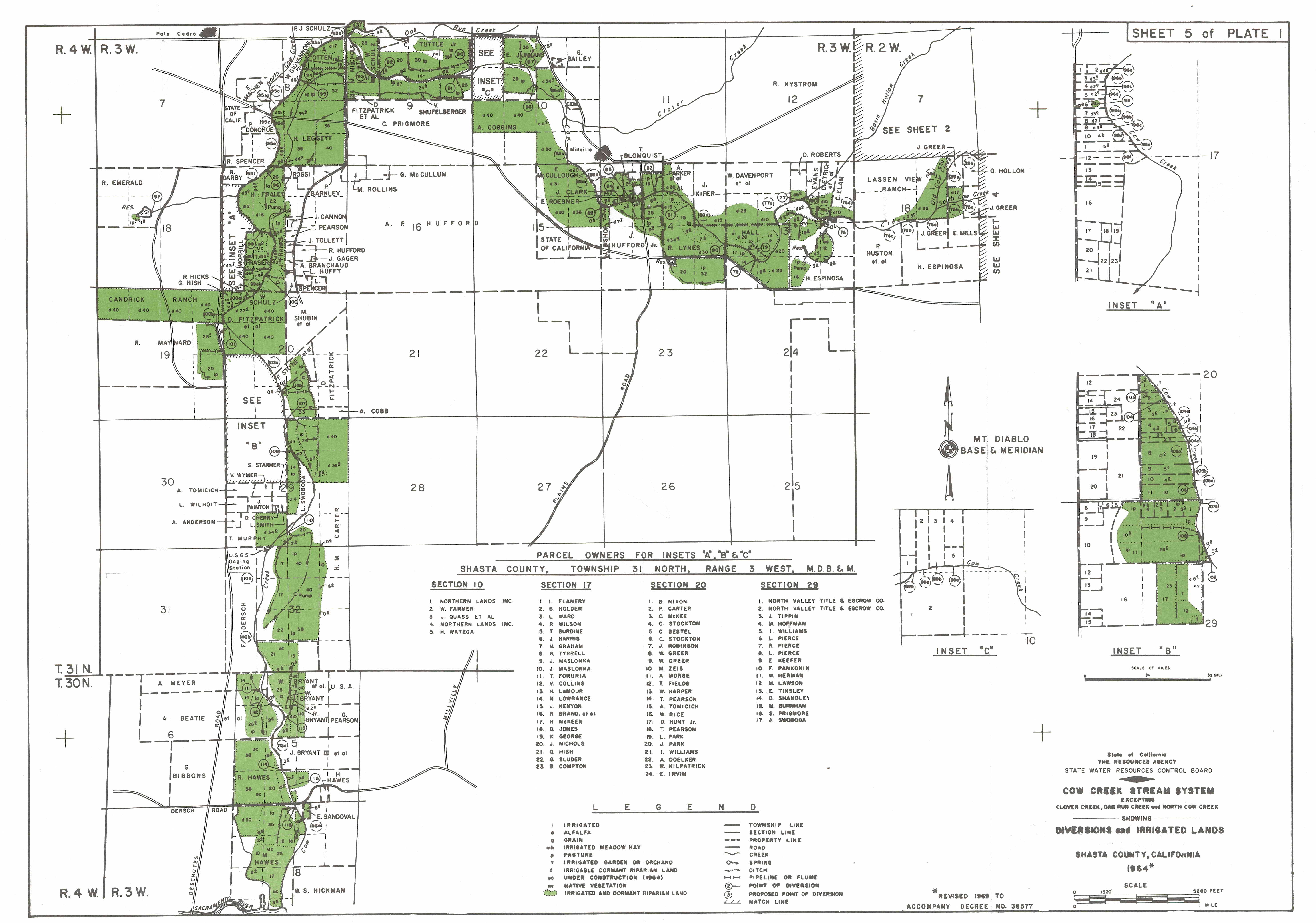
Diversions and Irrigation MapsHere are found detailed 1939, 1969, and other irrigation/diversion maps. They are here in varying size and some in original color. Historical Water Adjudication map dated 1939. It is 3x8 ft. in b&W and is 1.64 MB. It was scanned at 400 dpi. from the original linen drawings. Detailed Water Place of Use and Parcel irrigation map, showing 1969 and 1981 References in b&W 1x3 feet. 356K. The relationship of this map to the Adjudication Decree is unclear. ******************************************* Next are the 1969 Cow Creek Adjudication Maps in great detail. These are related to the Adjudication Decree of August 1969. That complete decree is available as document KC0005 here. These maps are the originals of the central Cow Creek Stream System showing Diversions and Irrigated Lands Revised 1969 to accompany Decree 38577, and are referenced in that volume on page 4. The maps below are direct scans of the original maps scanned while on loan from the State Water Resources Control Board.
The actual maps are available in large size Black and White typically 3x6 feet. Pick the ones you want from the index sheet above. These are physically large becasue they are direct copies of the drawings at the State Water Resources Control Board. They are compressed "tif" graphics typically about 800 KB to 1.5 MB in size at 400 dpi. The Black and White 7x3' 400 dpi sheet 1
This second set are direct copies of the origials of the maps in the back of original copies of the August 25th, 1969 Cow Creek Adjudication Decree. These colored originals were obtained from the State Water Resources Control Board and are in the original pastel colors. There are two sets here differeing in detail and size of the file. First is a set of five "JPEG" files that vary between 1 and 2 MB. These are in reasonable detail but are small enough to examine and e-mail. Use this index sheet above to pick out the areas of interest.
The second set below covers exactly the same areas, but they are in great detail, and are VERY LARGE, Typically they are about 45 MB each (that is 45 MEGABYTES). Physically they are the same size as those in the books - about 1 by 3 feet. These are suitable for engineering purposes. Use this index sheet above to pick out the areas of interest. They were scanned at 400 dpi.
When these are examined, it can be seen that there are many errors, ommissions, and over the past 40 years many changes of ownership. Included here on this site for cross referencing are the June 2007 property maps. from the Shasta County Assessors ofice. |